
ELUME is EMPACT’s custom software solution for electric utilities and their partners.
ELUME brings unparalleled innovation and efficiency of information to your organization and its projects.
Vegetation Analysis
System
Mapping
Loading Analysis
Engineering Design
Joint Use Management
Pole Attachment Inventory
Weather Conditions
NESC/NERC Requirements
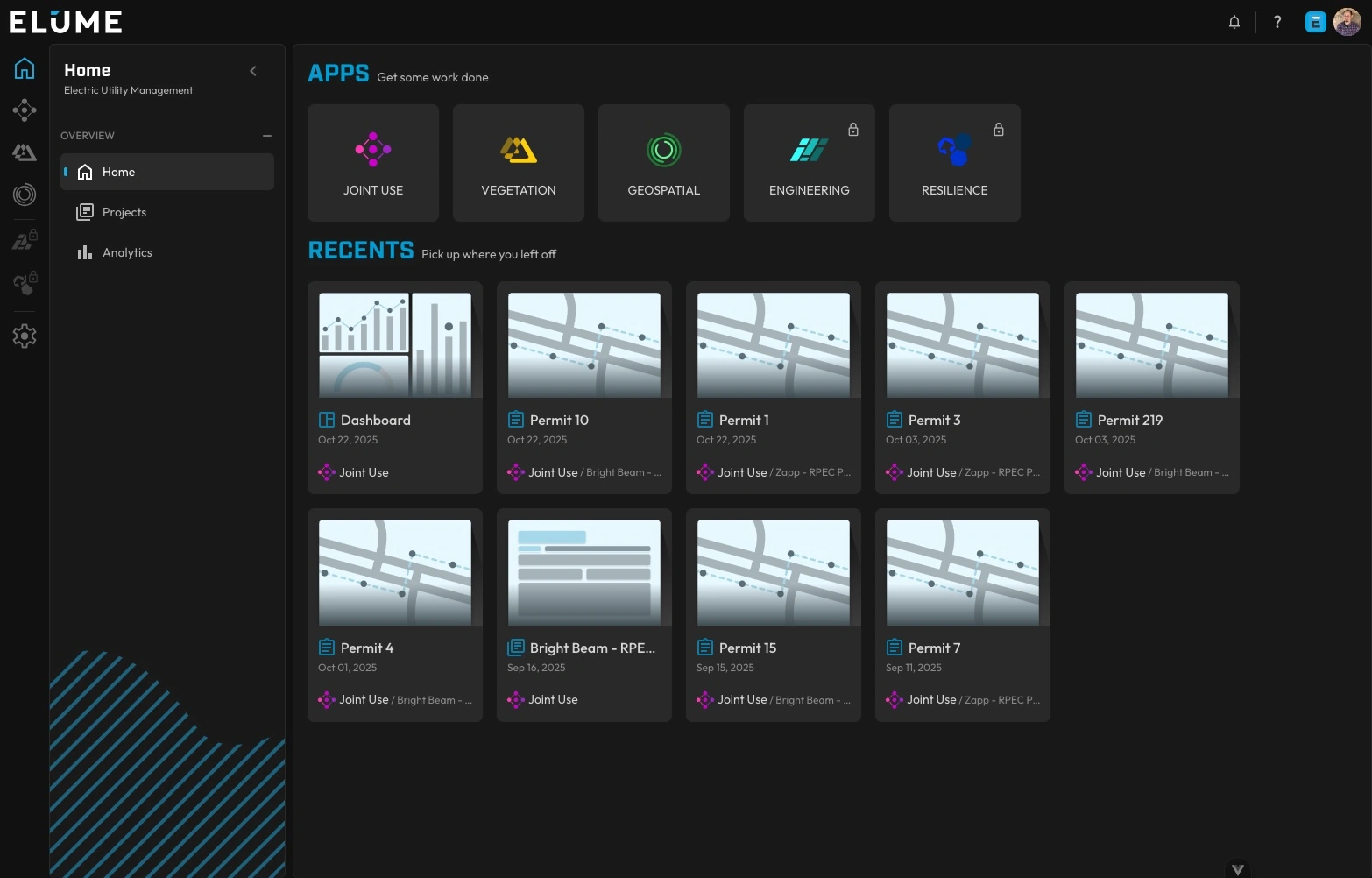
ELUME is our modular, cloud-based software that drives quality, speed, and collaborative interaction between internal and external partners.
The wide array of feature-rich tools provided by ELUME creates an open and user-friendly ecosystem in which users from different organizations can collaborate in real-time to advance the progress of their projects and initiatives, regardless of size, scale, or type.
Full Visibility of your Distribution Network
-
Modularity: Customize the ELUME platform to support your engineering projects, Joint Use permitting, vegetation management, and more.
-
Flexibility: Integrate data from multiple sources, including LiDAR, field inspections, and stakeholder inputs to provide comprehensive insights.
-
Scalability: Scale the ELUME platform to accommodate the growing needs of your organization as the grid evolves.
-
Security: Secured with the most stringent cybersecurity and data management controls, ELUME complies with all SOC2 Type 2 standards and measures.
ELUME MODULES
Joint USE Module
Revolutionize your permitting process
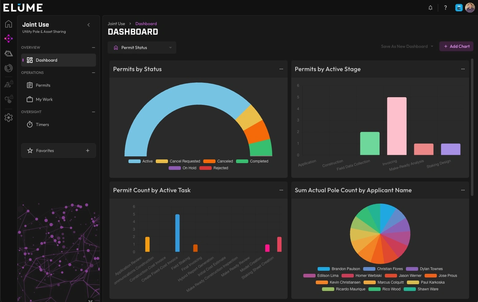
ELUME is a suite of apps (or “Modules”) that perform analytics and facilitate workflows in different areas. Today, the Joint Use module is readily available alongside EMPACT’s existing Joint Use services. Here are just a few of the benefits you get when you use ELUME:
- Pole License Agreement Modernization and Review
- Contract Management
- Application Submittals for Communication Attachers
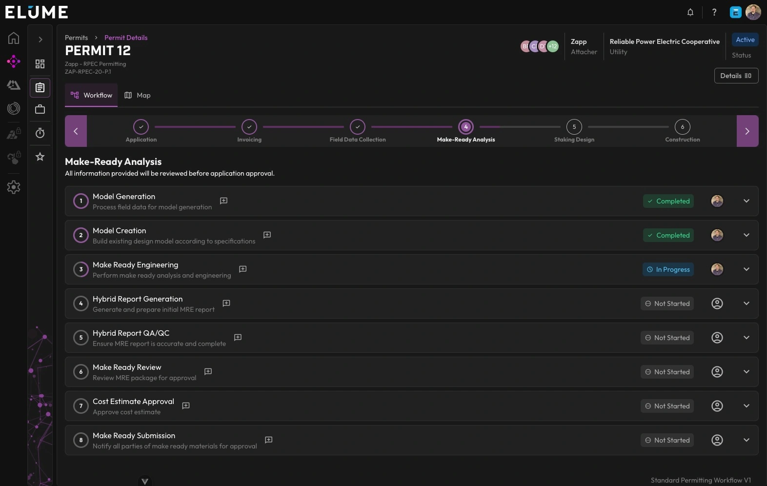
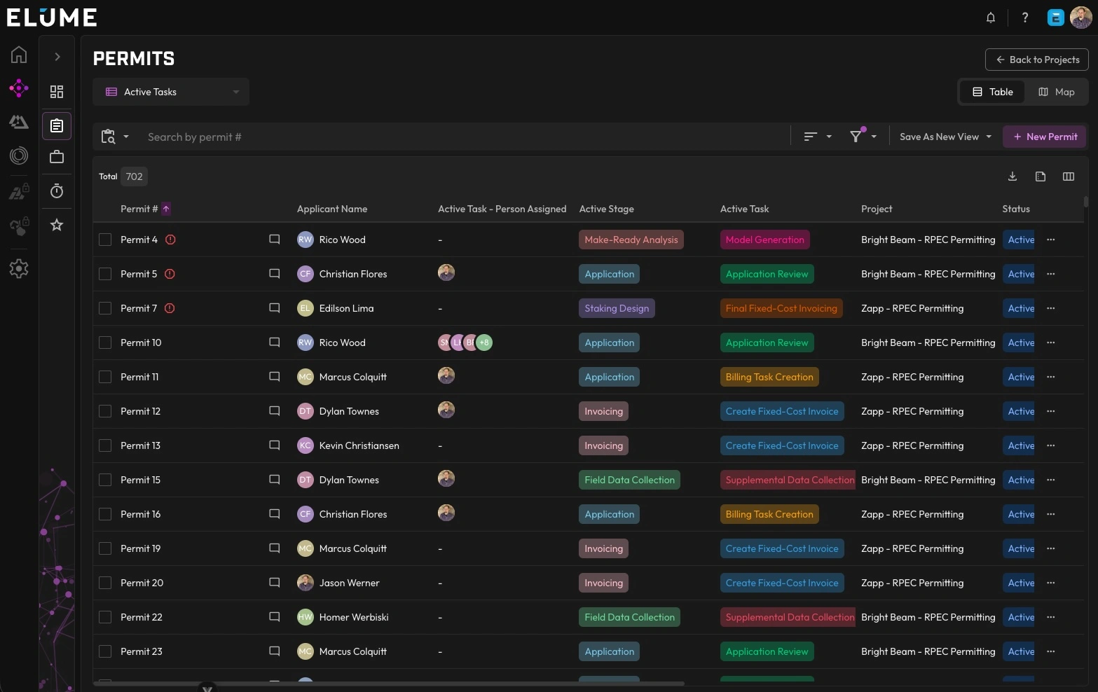
- Permit Workflow Tracking and Management
- Make-Ready Analysis
- Pole Location Mapping
- Billing Coordination
- Pole Attachment Rental Fee Records
- Custom Reporting
- Custom Dashboards
Vegetation MODULE
Transform Your Vegetation Management System
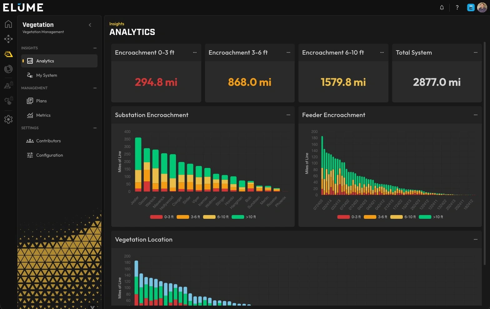
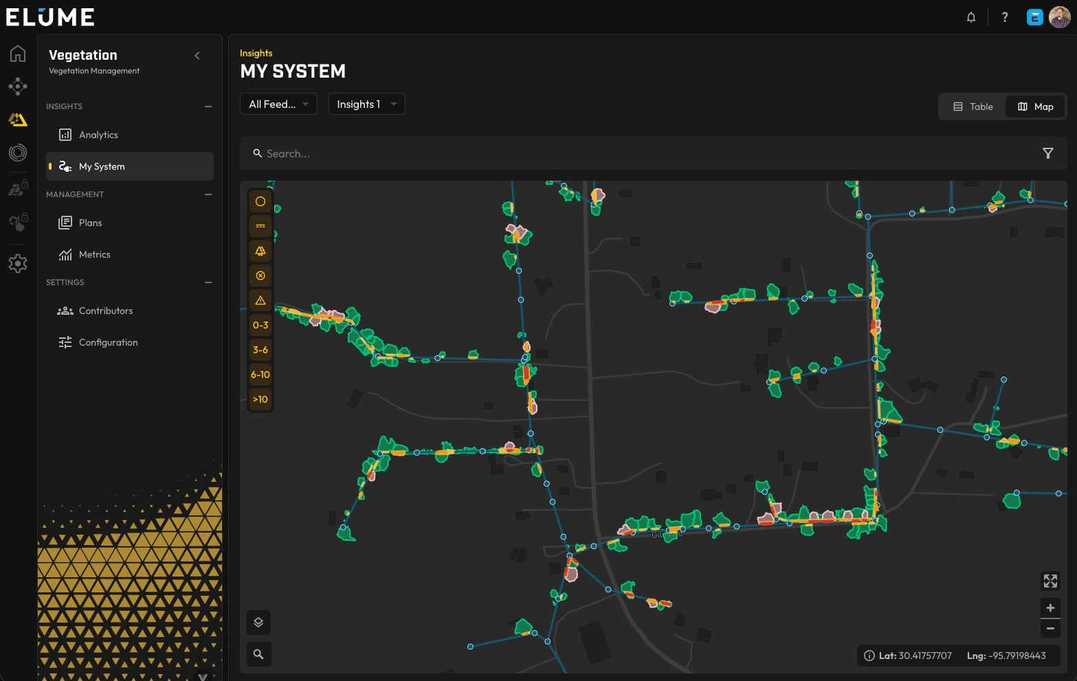
Optimize your vegetation management with data-driven intelligence. ELUME’s Vegetation Module converts complex environmental data into actionable insights that streamline planning, reduce operational costs, and enhance system reliability. Here are a few of the benefits of using ELUME’s Vegetation Module:
- Encroachment Identification and Categorization
- Hazard Tree Identification
- Trimming Reports
- Optimized Vegetation Management Planning
- Work Planning and Tracking
- Contractor Assignments and Trimming Workflows
- Custom Reports
- Custom Dashboards
- 2D and 3D Visualization
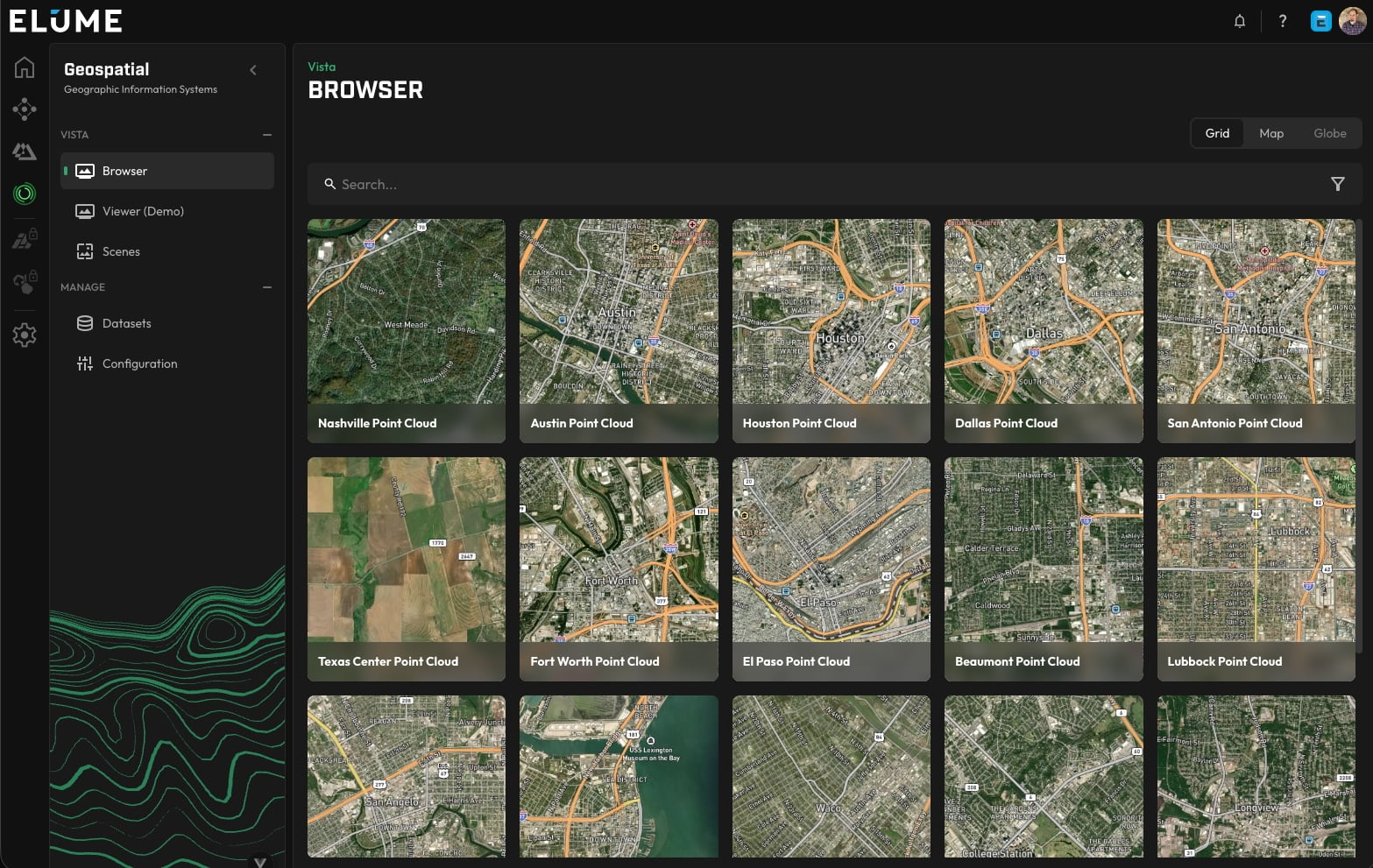
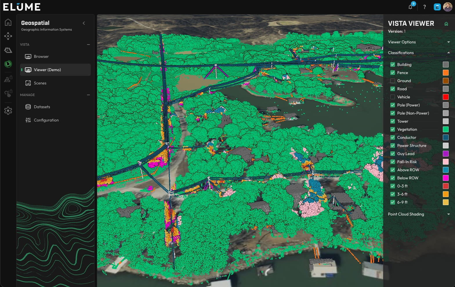
GEOSPATIAL MODULE
Full Access and Visualization of Your Data
Powered by numerous advanced datasets, ELUME enables users to make confident, data-driven decisions. The Geospatial Module provides intuitive access, powerful visualization, and seamless management of spatial data across the platform. Below are a few key features provided by the Geospatial Module:
- LiDAR Uploading and Viewing
- LiDAR Classification Profile Configurations
- Geospatial Dataset Upload and Management
- Customized 2D and 3D Dataset Viewing
- Advanced Access Control
- Secure Sharing of Datasets with Third-Party Users