FUNCTIONAL AND SCALABLE NETWORK SOLUTIONS.
Geospatial Data & Mapping Services
Improve all facets of network asset management.
Geospatial Services
Get a faster, clearer, and more accurate view of your system.
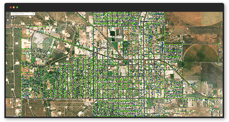
We update and validate asset locations, pole records, attachments, and field conditions using advanced data collection and analysis. Our approach also delivers vegetation insights across your entire system or targeted areas.
By combining remote sensing, lidar, and geospatial analytics, we provide the data you need to manage your network more efficiently and cost-effectively.
The result: better visibility, smarter decisions, and a more reliable system.
EMPACT’S PROCESSES CAN BE LEVERAGED FOR VARIOUS USE CASES
- Asset inventory and management
- Digital Network Modeling
- Data conflation
- Substation mapping
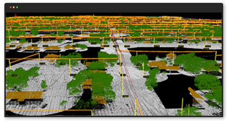
- Pole lean analysis
- Clearance Analysis
- Digital elevation modeling
- Corridor design and maintenance
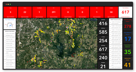
BENEFITS OF EMPACT'S APPROACH
- Rapid, accurate survey of overhead conductors and poles
- Complete inventory of conductors, transformers, SCADA devices, poles, etc.
- Accurate mapping of as-built infrastructure
- Accurate and rapid identification of obstructions
- Rapid Joint Use audit